|
Indian Creek Valley Hiking and Biking Trail |
one moment while we fetch a trail picture
|
|
|
Indian Creek Valley Hiking and Biking Trail |
one moment while we fetch a trail picture
|

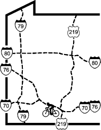
The Indian Creek Valley Trail will run for about 19 miles from Jones Mill through Champion, Melcroft, and Indian Head to the Youghiogheny River along the east bank of Indian Creek, nestled in the valley between Chestnut Ridge and Laurel Ridge. It has more grades and curves than you’d expect from a rail-trail. The trail has been developed in three sections with undeveloped trail between the sections The main section, 7.8 miles of limestone surface runs east from Route 31 to south of Indian Head (SaltLick Township Line), a short section, 0.8 of limestone runs from Jon Mt Rd to the east, and the final section, also limestone runs east and west from the Camp Christian and Show Time trailheads.
The route was developed between 1906 and 1910 as the Indian Creek Valley Railroad, which carried passengers and freight down Indian Creek to meet the B&O Railroad on the north side of the Youghiogheny River. Above Melcroft, the primary freight came from the logging industry; below Melcroft it came from the mining industry. Since the freight was mostly headed downhill, this railroad could tolerate relatively steeper grades than most.
Jones Mill to SaltLick Township Line
The trail starts east of Jones Mill about 0.1 miles south of the Blair Brothers trailhead, near the intersection of SR31 and SR387. At the end of the guide rail on the south side of SR31 a set of steps leads down to the trail. From here to Champion the trail is a single track limestone path. It use to be a full wide path, but it has narrowed from disuse. It starts out passing the backyards of a few homes. At Gill St it transitions to woods with an occasional meadow.
At Champion the trail runs south for about a mile through woods, then comes into sight of Mountain Pines Resort, an immense RV pack. Adjacent to the swimming pool (a fee to swim) at the back of the campground, a footbridge connects the pack and the trail. The trail then passes some homes and camps near Nebo,.Half a mile later, the trail passes a lake, then crosses Fowl Hill Rd (which leads to Mel-croft) and enters the woods. Just after Fowl Hill Rd, a spur trail leads right, crossing Indian Creek on a refinished trestle, to the Melcroft trailhead and the nearby G&D store on the main road (PA381/711). Another pastoral mile and a half brings you to some picnic tables overlooking the creek. Shortly thereafter, the trail passes a couple of mine acid remediation ponds. Notice that the far one (the start of the remediation) is much oranger then the near one as it does its job of settling out the bad stuff. The next mile, to the Indian Head trailhead on Hull St, is more developed.
To continue on the trail, turn right/west on SR3089 (Hull St), go one block (300 ft) and turn left/south on a dirt road across from Resh’s store before Indian Ck. This road swings left, climbs slightly, and crosses the railroad bed. Turn right at the sign for ICV Trail. The trail continues for about 1.5 miles to the Salt Lick Township line.
East of Jon Mt Trailhead for 0.75 miles
Heading east on a limestone surface from the Jon Mt trailhead the trail parallels Indian Creek for about 0.8 miles in the woods. When the limestone stops, there is a dirt path for about 0.15 miles that ends at an old railroad bridge with just the ties showing.
Show Time Trailhead Past Camp Christian to the Youghiogheny River
Indian Creek Valley Hiking and Biking Trail
Location 1 mile east of 381 to Youghiogheny River, Fayette County
Trailheads Show Time, Camp Christian
Length, Surface 4.7 miles packed crushed stone
Character Little-used, wooded, shady, notable grade
Usage restrictions No motorized vehicles; no horses
Amenities None
Driving time from Pittsburgh 1 hour 5 minutes south-east
The trailhead Show Time is not at the end of the trail but about 0.5 miles west of the limestone trail start. It is a pleasant out and back ride through woods along side Indian Creek. After crossing SR381 the trail remains in the woods to the Camp Christian trailhead. Passing through the parking lot, the trail surface changes to a gravel road for 0.3 miles to along side the Indian Creek reservoir. Her the trail bears left onto the limestone path which continues to the Youghiogheny river. The gravel road continues for about 0.4 miles to the Dam for the reservoir. The dam is a very impressive rock structure.
The main trail bends away from the river and passes through a small cut and then enters the Indian Creek Gorge. The trail is on a bench about 60 to 70 feet above the river. One can occupationally see the impressive river rapids as the stream drops rapidly to the Yough. The trail picks up a distinctive downward slope, much steeper then is typical for a railroad grade. As mentioned must freight was being hauled down to the Yough with very little coming up. The trail ends about 50 feet above the Yough at an undecked railroad bridge crossing the creek to join the B&O tracks.
| Location | Jones Mill to Salt lick Township Line, Fayette County | ||
| Trailheads | Blair Brothers, Champion, Melcroft, Indian Head | ||
| Length, Surface | 7.8, miles packed crushed stone | ||
| Character | wooded, shady, notable grade | ||
| Usage restrictions | No motorized vehicles; no horses | ||
| Amenities | Rest rooms, food, fishing | ||
| Driving time from Pittsburgh | 1 hours 0 minutes |